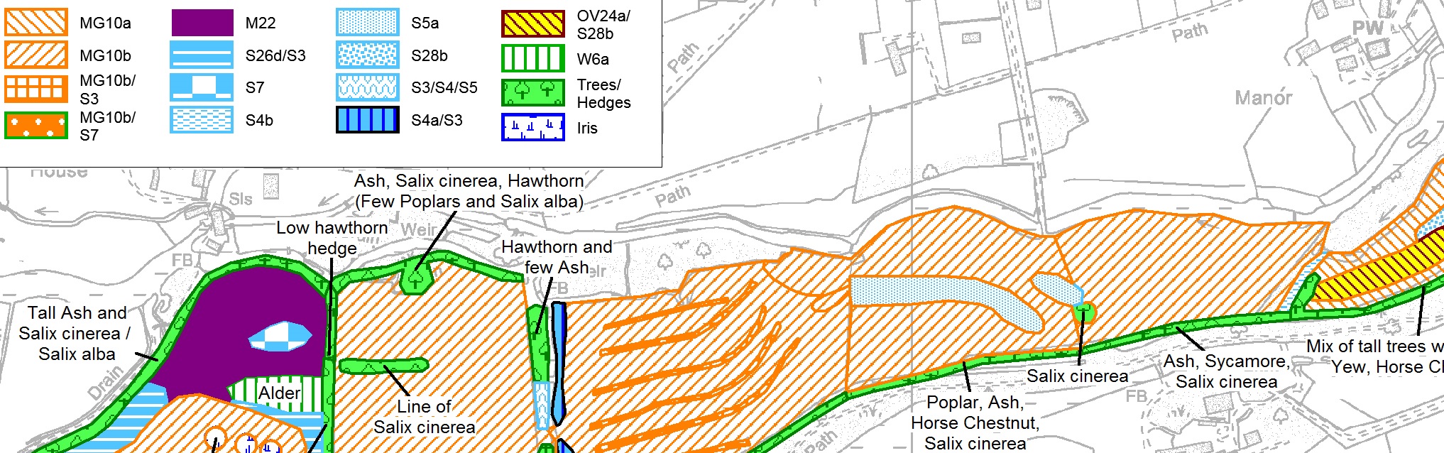
Mapping and Data Analysis
We are qualified GIS experts and can offer a range of mapping and data analysis services, including digitising, spatial analysis, spatial database design and presentation mapping. We have developed a template for standard Phase 1 and NVC habitat mapping, can carry out comparative analyses for research and reporting, multi-criteria analysis for modelling, as well as presentation mapping for habitats and site features. We can provide data in ArcGIS and MapInfo formats.
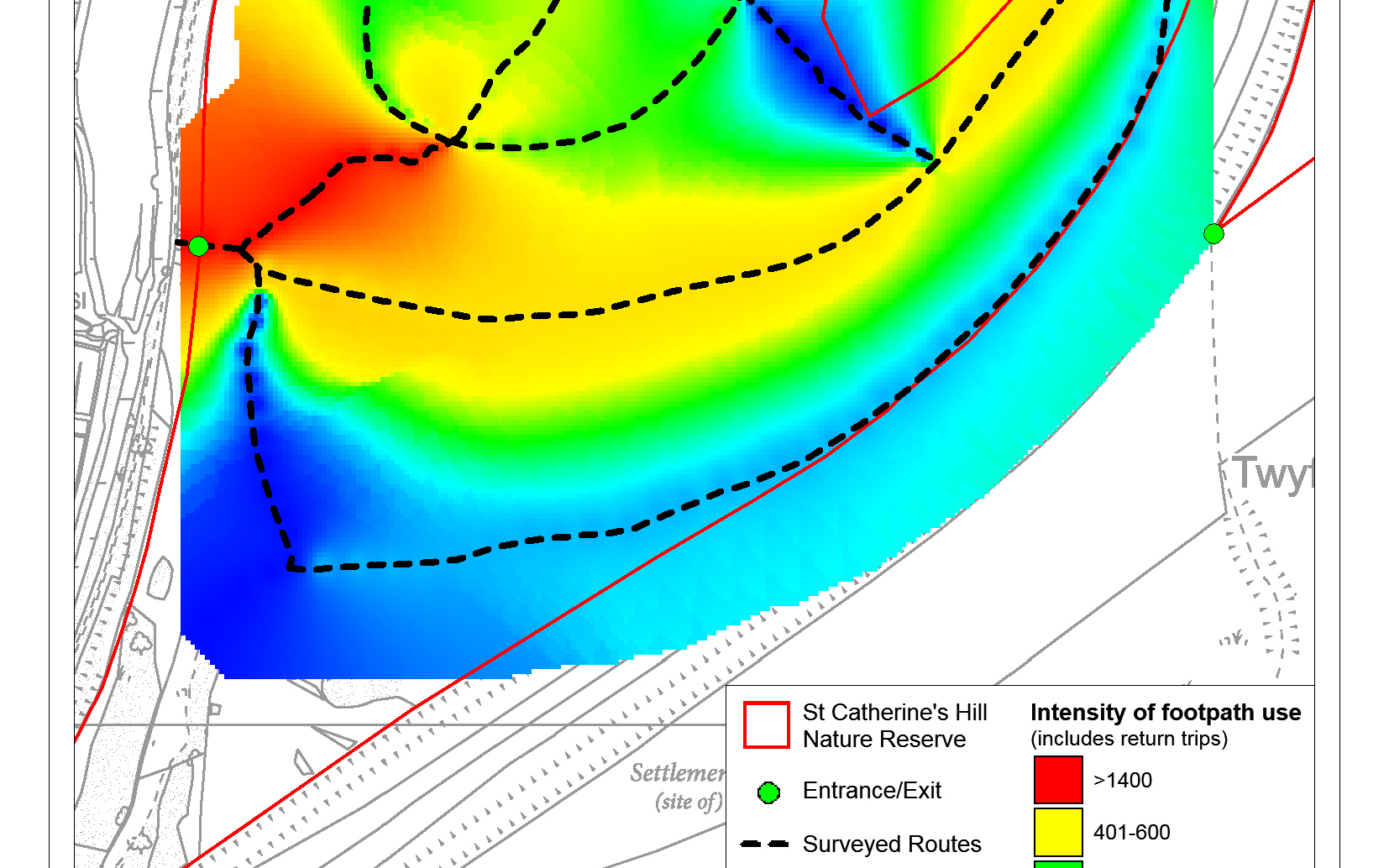
Geospatial Services
We are able to act as planning agents for practical habitat management and capital works on your site. We can calculate site levels and produce scaled design drawings, and are also able to provide additional spatial assessments required for planning permission and other consents. Our supporting statements and accompanying scale drawings, block plans, site plans and location maps are of a high quality and professional standard. We have a 100% success rate for gaining planning permission as the planning agent for Hampshire and Isle of Wight Wildlife Trust.